What are the most useful Apps?
Owen Davies
With the changes for SuDS in April and the steady self-examination and self-deprecation which has been undertaken since Christmas, I thought it may be time just for a little light relief from the disappointment of the last Governments decisions and actions surrounding SuDS. So this short blog is just looking at what Apps are available which could make life designing, assessing, choosing and implementing possible SuDS a little easier or help with Flood risk Management in general.
I must caveat that I am an Apple fanatic so unfortunately if your phone is Android I really couldn’t say if it is either available or has the same level of functionality (just to keep a level of disappointment going.)
I will assess the Apps around their use and both the Pros and Cons. For ease of reference I am going to assign a new symbol of the emoji raindrop (I should acknowledge Spokesdrop, NEORSD for the inspiration). Although this is in part a light hearted assessment and my ratings are purely subjective, I must add these are Apps I use pretty much on a day to day basis both professionally and at home and they do actively and positively contribute to how I undertake my job and also recreation.
iGeology – Free
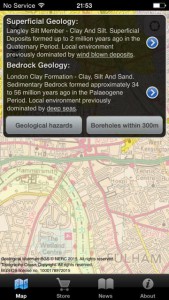 Pros – It has the geological map for the UK both superficial and bedrock it gives a good overview of what is beneath your feet which gives you a useful indication what SuDS, infiltration or attenuation, would be most appropriate for the location you’re investigating
Added Bonus – it will tell you what boreholes are available near you, so you can make a note and have a more detailed look when you’re back in the office.
Cons – Unfortunately it doesn’t go down to property level so it is relatively general in terms of location.

Google Earth – Free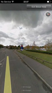
Pros – What isn’t there to say about Google Earth on your phone? Access to street View on your phone. You can also access your own google earth maps, so if you have done some work you should be able to reference it on site.
Cons – You don’t have the full functionality that you normally would on your desktop

AutoCAD 360 – Free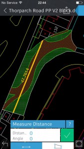
Pros – If you use AutoCAD you will be able to download your drawings whilst out onsite so you can check dimensions, you can also amend your drawing onsite and note any changes so you can amend the drawing back in the office.
Cons – Autocad really needs a desktop and a large screen, a phone screen is not necessarily the best screen to work on.

OS Map Finder and OS Locator
Bit of a cheat on this one as it is two different Apps but both made by Ordnance survey and both very helpful tools.
OS Map Finder – Free
Pros –– This is really your very own OS map on your phone the App is free but you pay for the tiles of the area you want and you can either purchase the 1:50k for 79p each or 1:25k for £2.99. This gives you a wider overview of the area you’re in, you can see watercourses, contours public rights of way and everything else you expect on OS maps a very helpful tool on site.
Cons – There are times when you just can’t beat a good old fashioned paper map

OS Locate – Free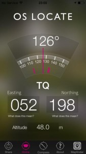
Pros – Is just a very simple tool which tells you your current position, so is helpful in getting the right tile for your drawings when you’re back in the office (or you are genuinely lost)
Cons – It would be nice if it was part of the Map Finder App

Plant Tracker – Free![]()
Pros – Great for when you’re out onsite and you notice a plant that shouldn’t be there, you can check whether it is an invasive species and you can report it then and there.
Cons – Could probably have more species.
![]()
Dropbox – Free
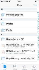 Pros – Easy access to your documents on the move, you can check reports and client instructions on site or on the move without having to rely on carrying tomes of documents. You can also share documents on the move with those who need to be involved. (You could even store all the great new CIRIA documents, such as Designing for Exceedance, and the soon to be released SuDS Manual)
Cons – As with Autocad navigating large documents on a phone screen doesn’t always work that well. Also there are many other similar cloud applications available to use.

Runkeeper – Free
Pros – If you’re going to site keep a track or the route you’ve taken, with the added bonus of informing you how many calories you have disposed of and how long it’s taken you (good to show to the boss you have actually been working)
Added bonus – You can download your data and import it into Google Earth so you can see where you have been and where you may need to inspect, which you can look at if you have the Google Earth App and your own google map.
Cons – It can be used against you in terms of how long you were at a single point which suspiciously looks like a pub. Also makes you feel guilty if you don’t manage to maintain regular exercise!

Though because of the guilt factor

River App – Free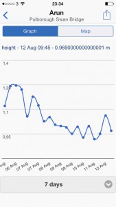
This is a new App for me but it does allow access to data for 1151 rivers in the UK with various gauge level locations along the rivers with data for the past 7 days. It can therefore give a good indication of how the river is responding to recent weather events so you can start to build a picture of how the river responds in certain circumstances.
The App has been developed for Kayakers and Canoeists so they know what to expect when they go out, but as mentioned its good real time data.
As it’s new to me I will only award it two happy raindrops.

Rain Alarm – Free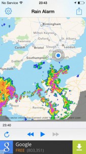
Pros – Real time rain radar information, great for tracking rainfall and also getting a good idea of what’s coming your way and the intensity. Also good for planning the walk or drive to the station.
Cons – As I’ve got the free version the blinkin’ adverts.

Blinkin’ adverts

Note: susdrain nor CIRIA endorse the specific Apps mentioned above. This just useful information, please let us know if there are other freely available apps out there!